|
芝浦工業大学 工学部 土木工学課程 中川 雅史 研究室 = ジオインフォマティクス研究室 Program of Civil Engineering, Shibaura Institute of Technology NAKAGAWA Masafumi Lab. = Geoinformatics Lab. |
|||
| [HOME] |
[Lab members] |
[forLabMember] |
[Photos] |
| [Researches] |
[Papers] |
[Log] |
[Access] |
| ■ RESEARCHES | |||
| ■ What is 'Geoinfomatics' ? |
Our research's topics 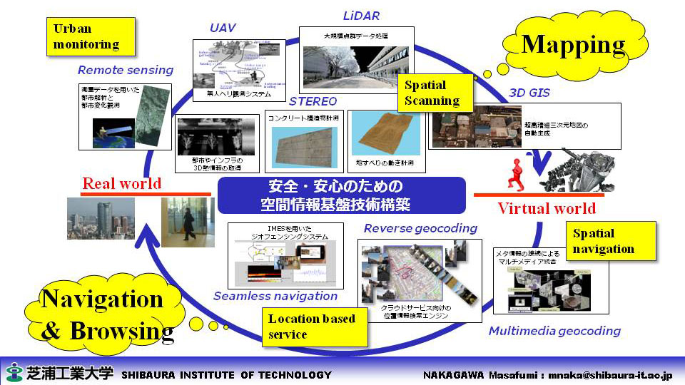
ジオインフォマティクスの技術を用いて,見たものそのままを,空間データとして 「いかに正確に取り込むか」「いかにリアルタイムに取り込むか」「いかに効率的・効果的につかうか」 ということを実現するために,生活から・地上から・上空から・宇宙からの目を通し, 「空間のデジタルコピー」という研究に取り組んでいます Read more.. |
||
| ■ Development of Surveying Platforms |
- Lunar base construction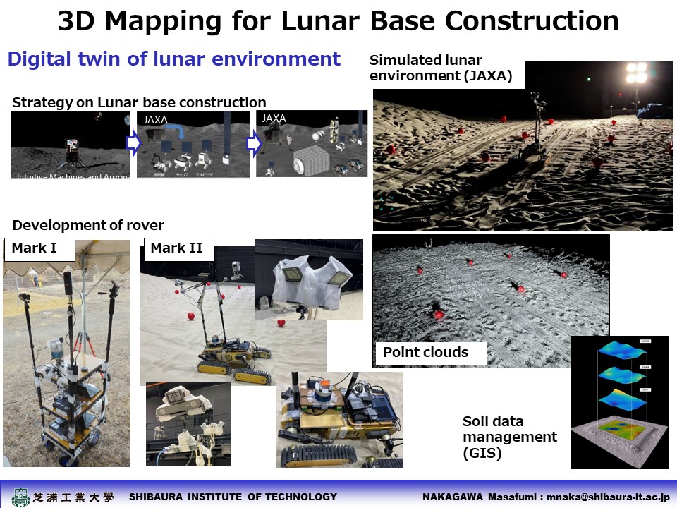
- Water-borne mobile mapping with indoor-outdoor seamless positioning 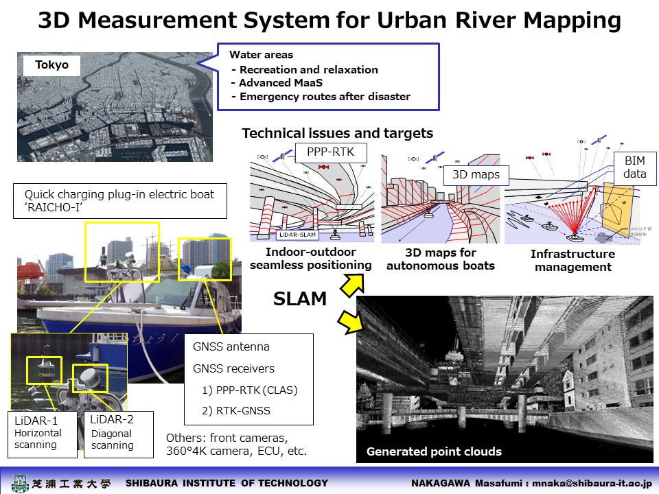
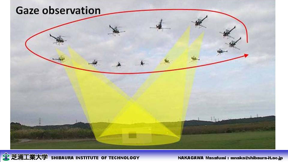
- UAV with indoor-outdoor seamless positioning 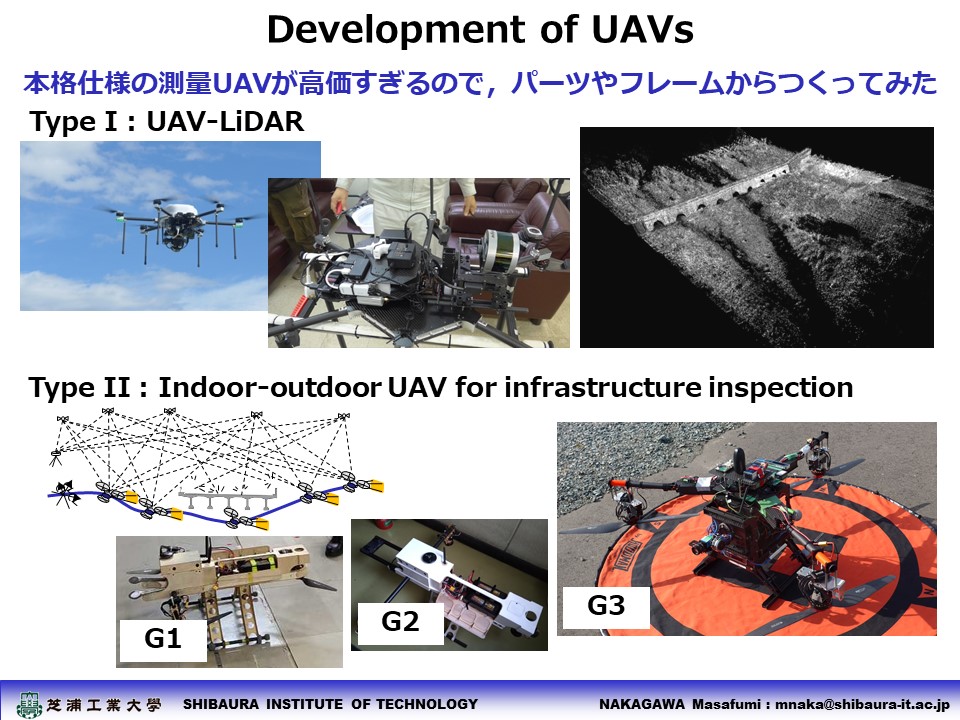
- Instant MMS with SLAM 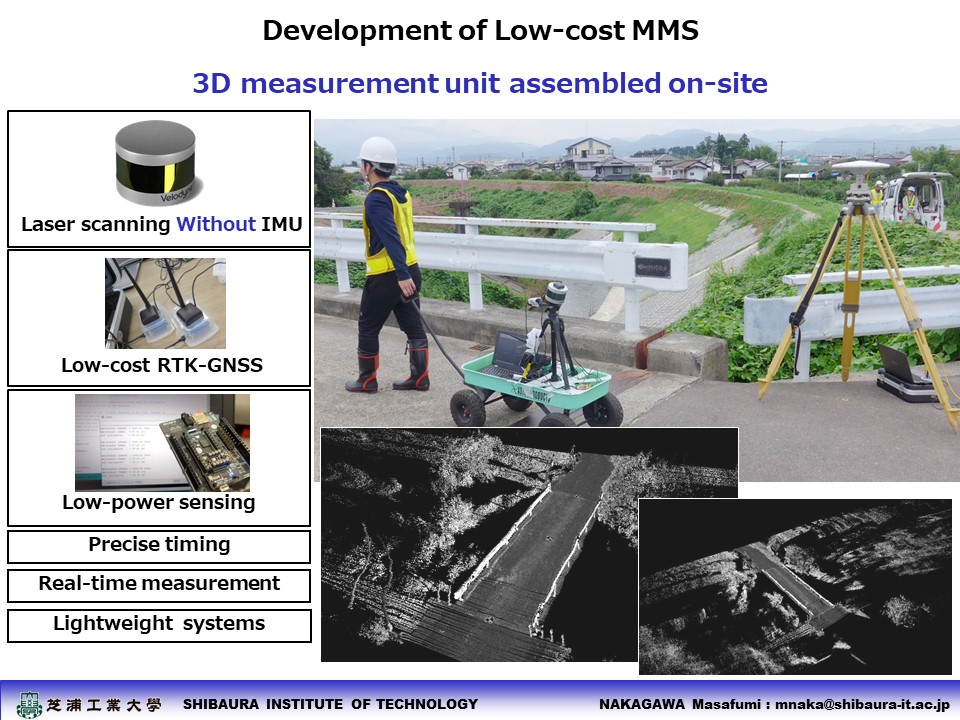
- Instant ICT construction vehicles 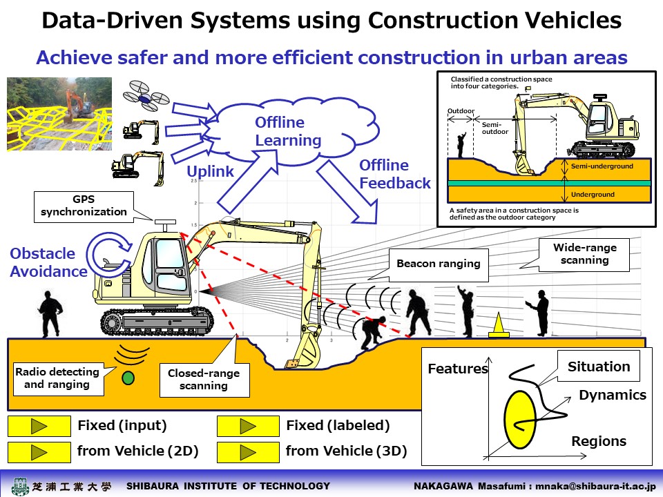
|
||
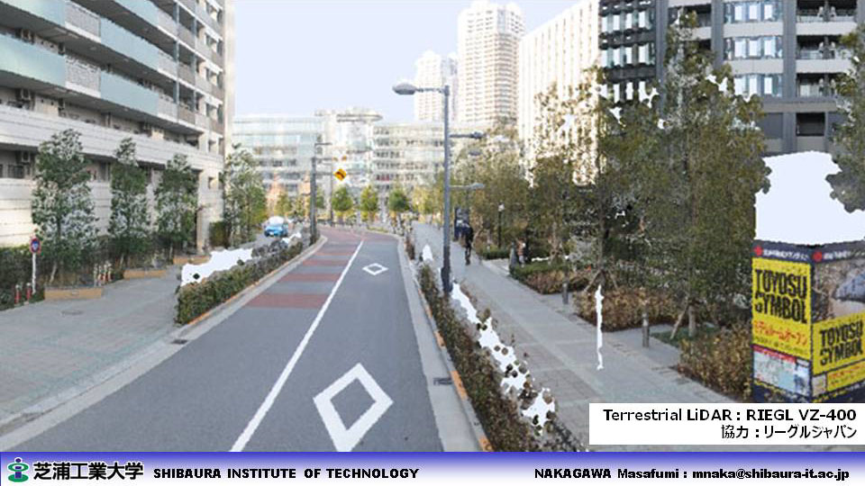
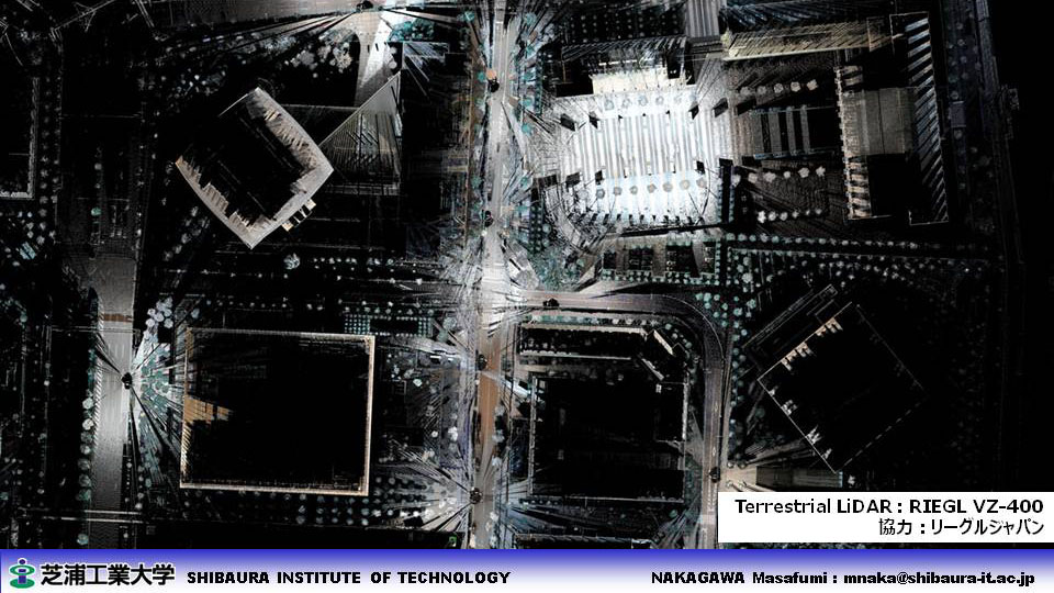
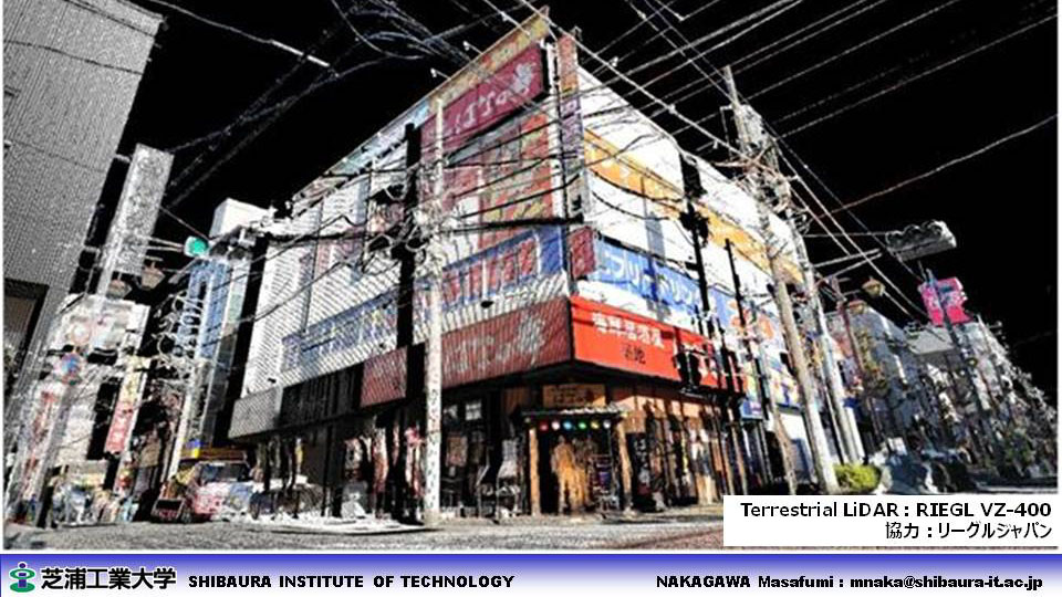
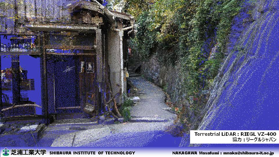
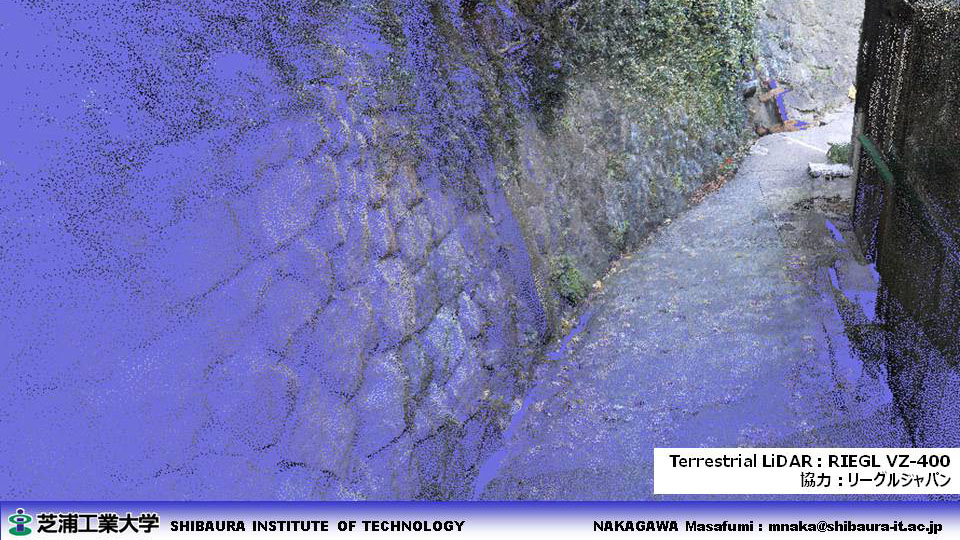
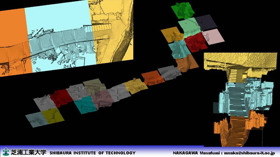
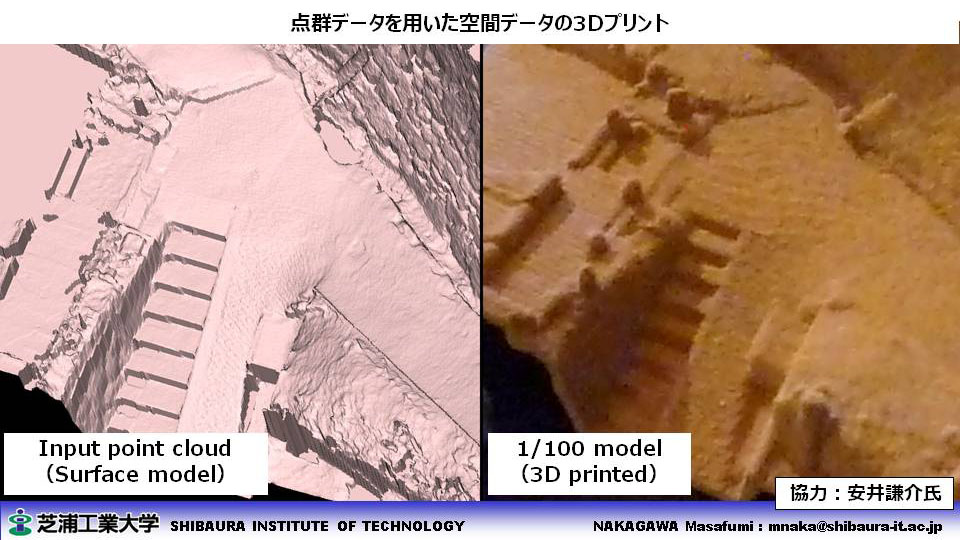
| ■ 3D Measurement & Modeling (LiDAR) |
- Terrestrial LiDAR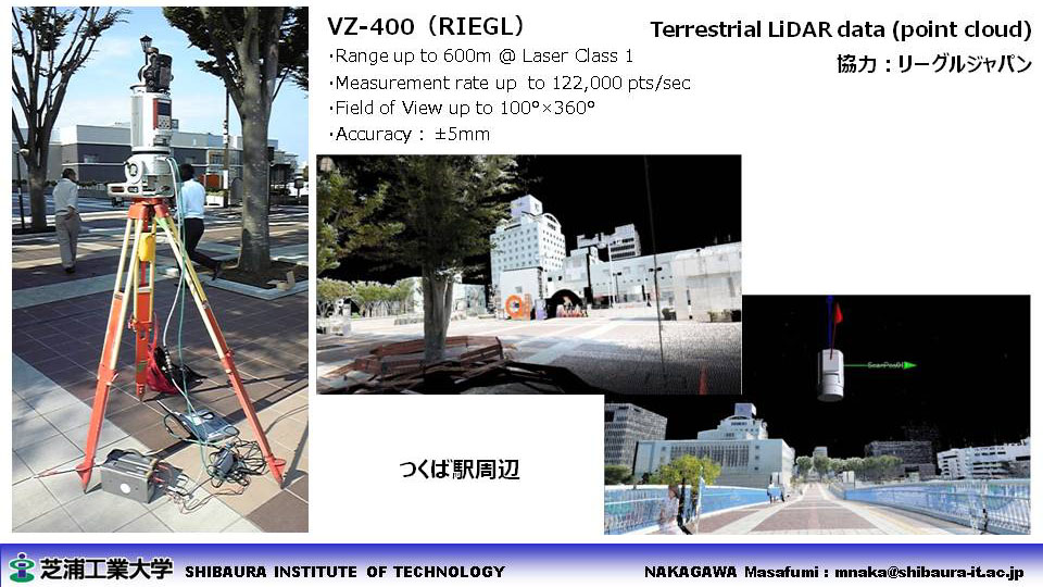
- MMS (Land-based Mobile Mapping systems) LiDAR 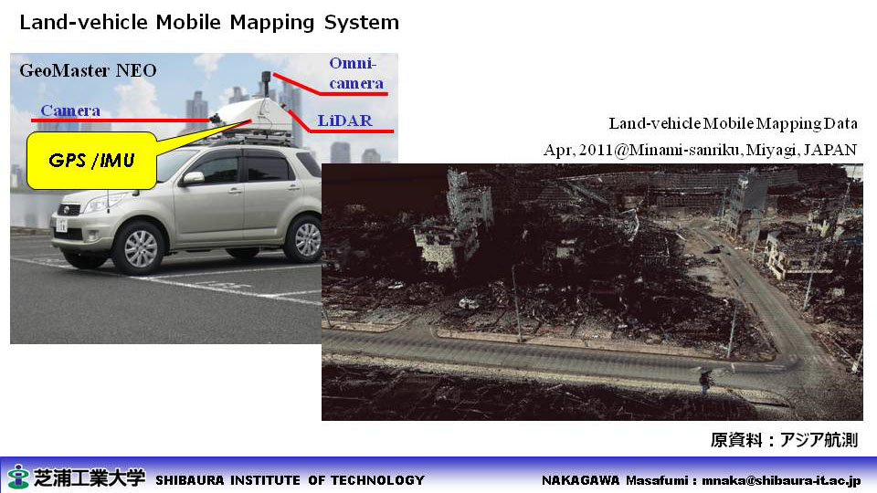
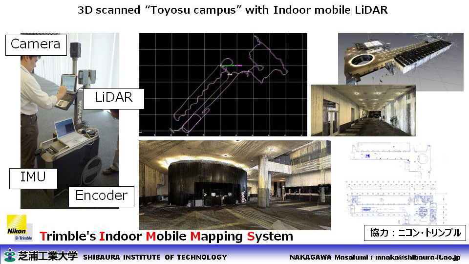
- Indoor MMS LiDAR 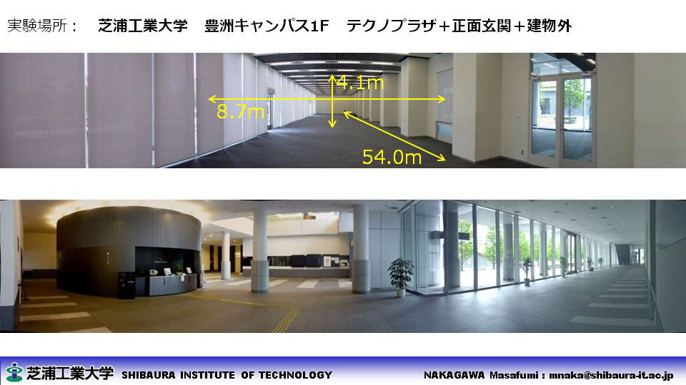
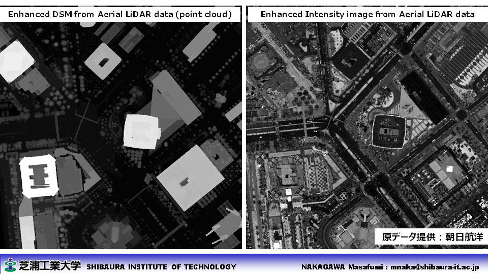
- Aerial LiDAR 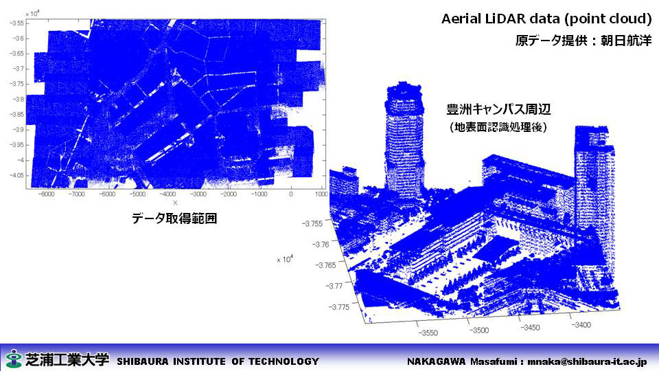
|
||
| ■ 3D Measurement & Modeling (Photogrammetry and Computer Vision) |
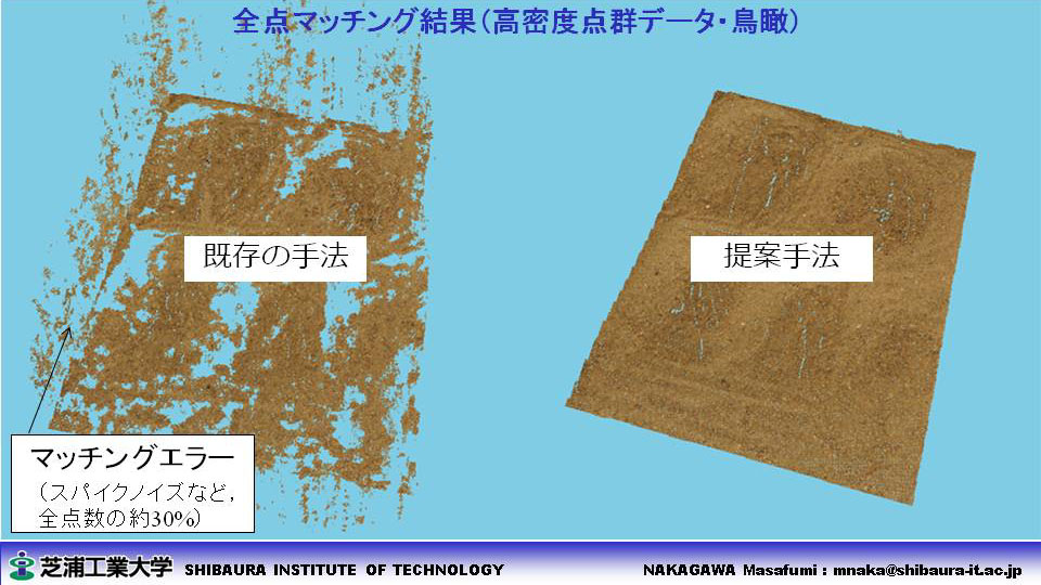
- Dense point cloud generation for Mt.Fuji surveying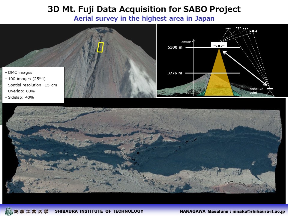
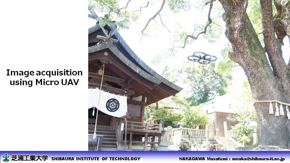
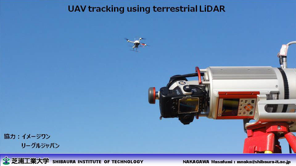
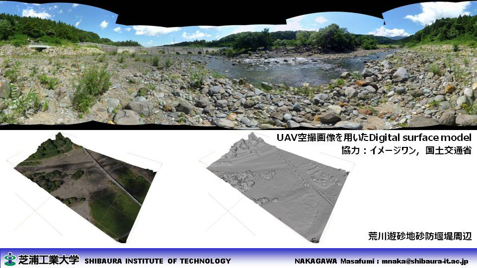
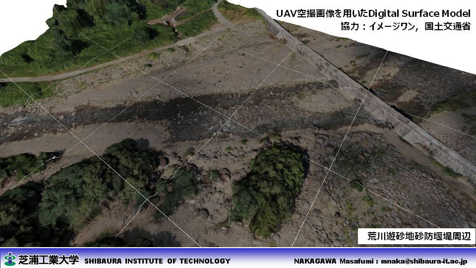
- Data acquisition from UAV 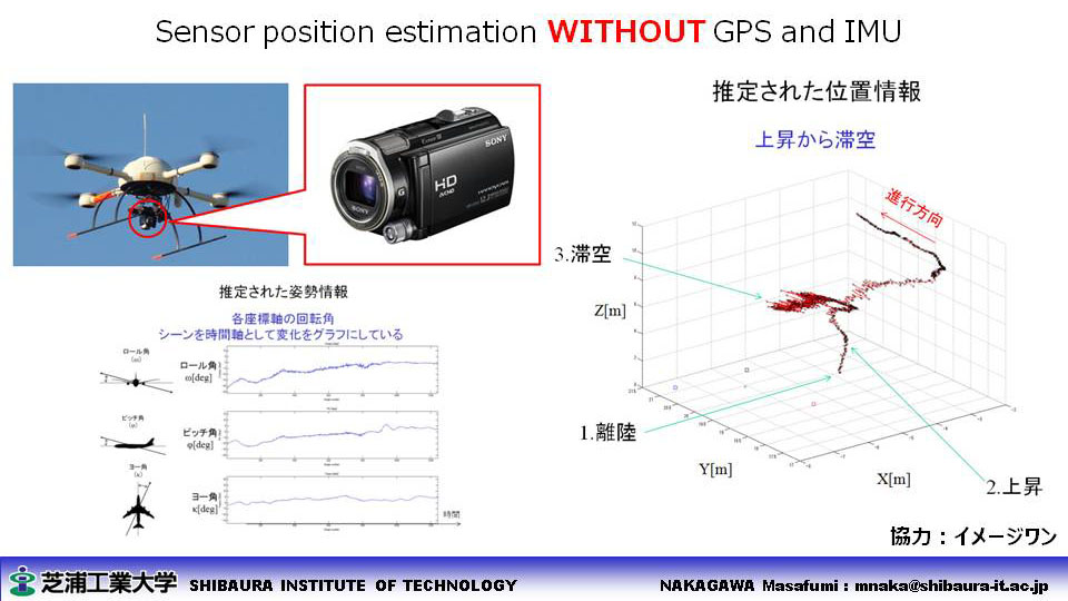
- 3D modeling from Three Line Scanner 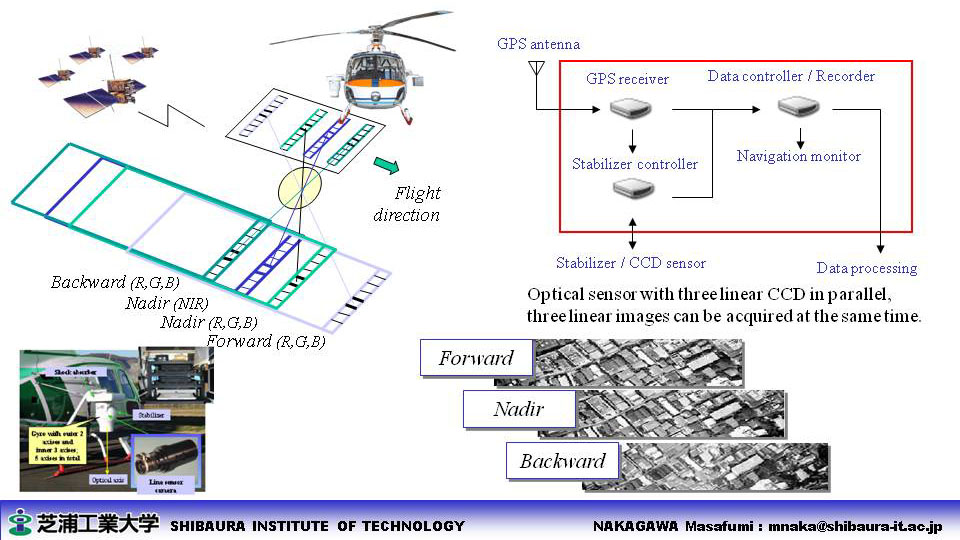
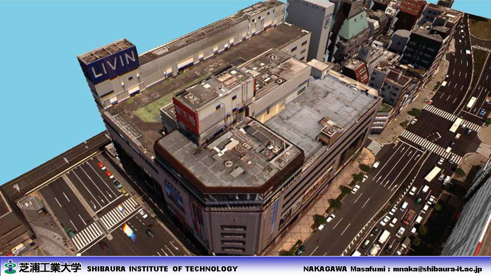
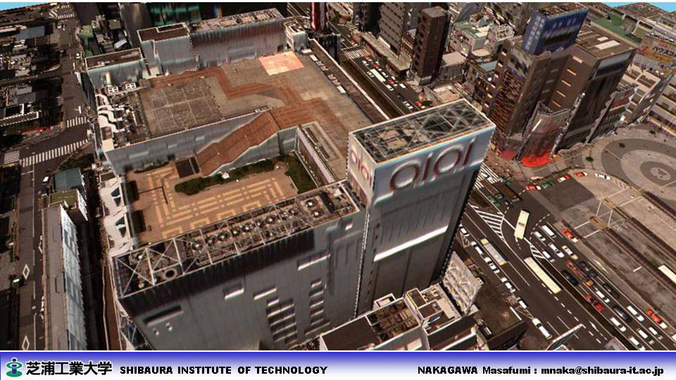
- Image matching using Tablet PC 
|
||
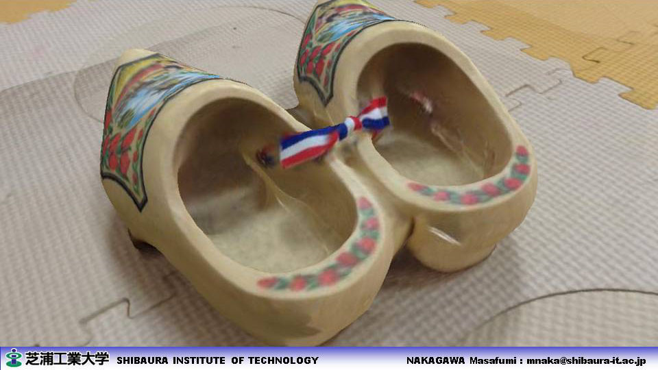
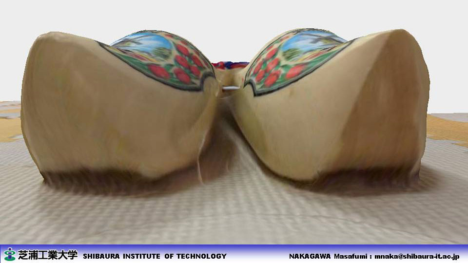
| ■ Point-cloud Visualization and Segmentation |
- Point based rendering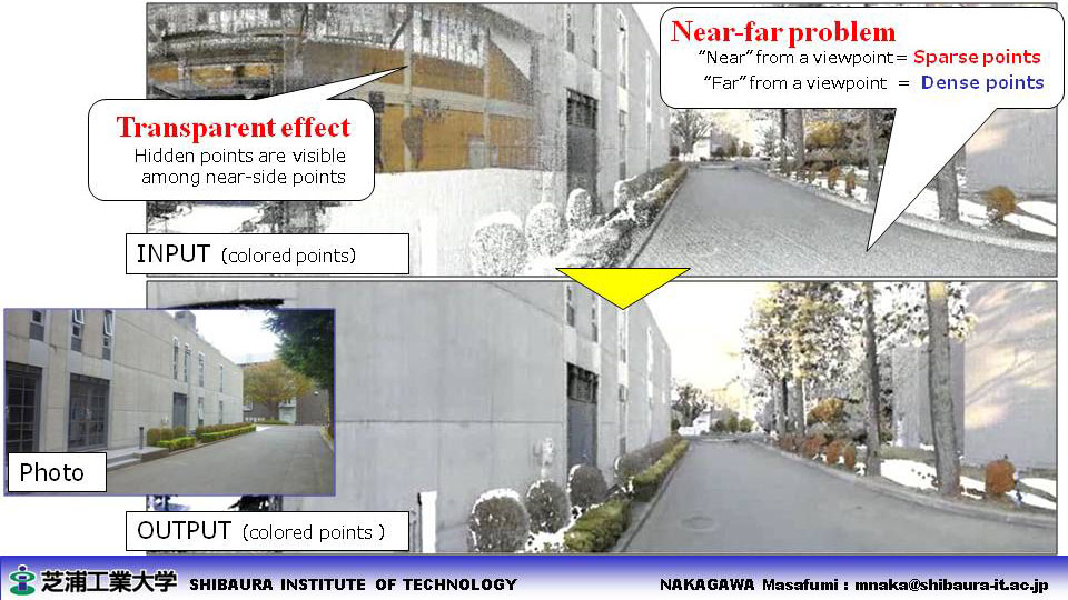
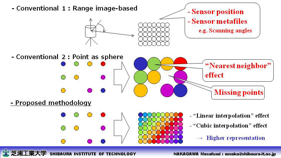
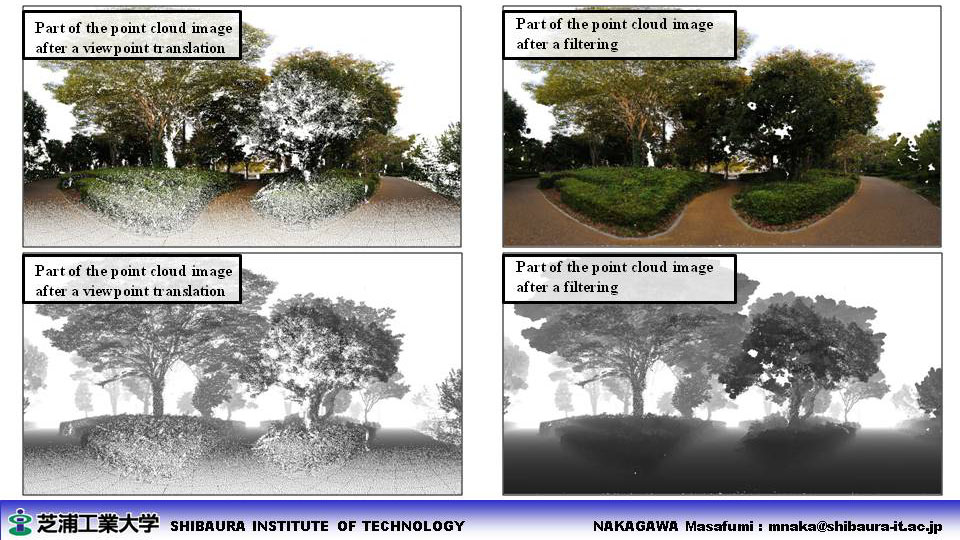
- Point cloud segmentation 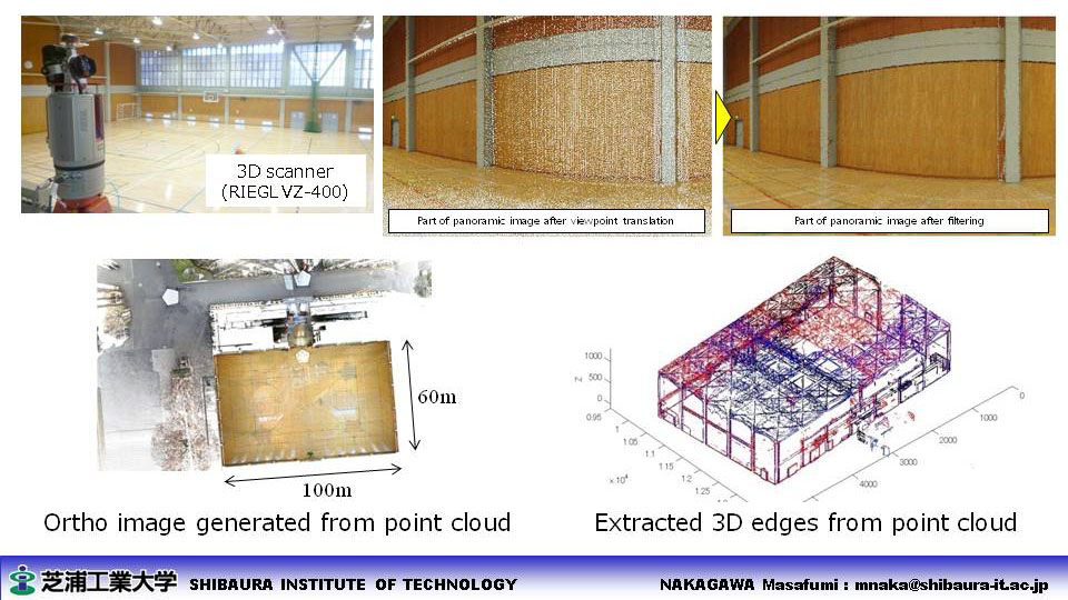
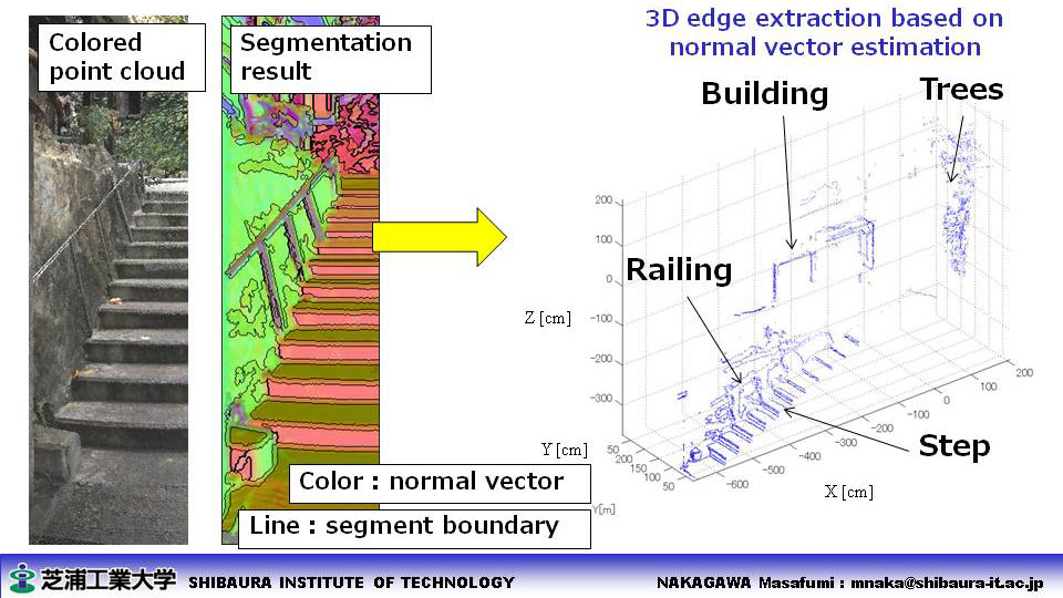
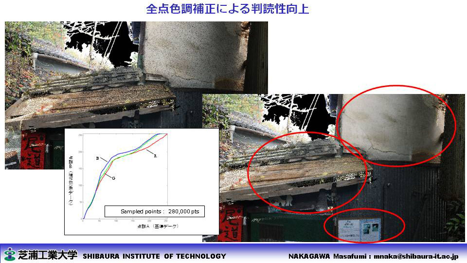
- Point based color adjustment 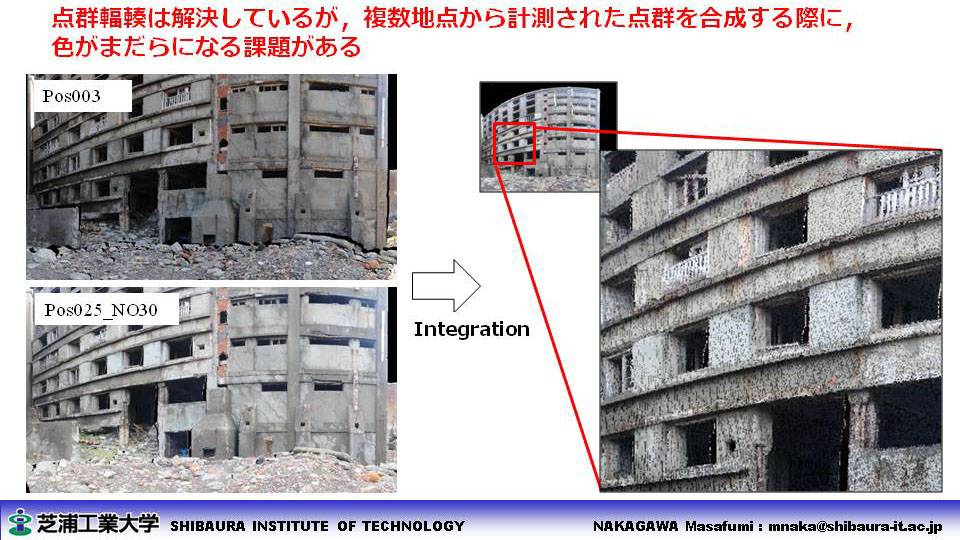
|
||
| ■ Seamless Positioning and Geofencing |
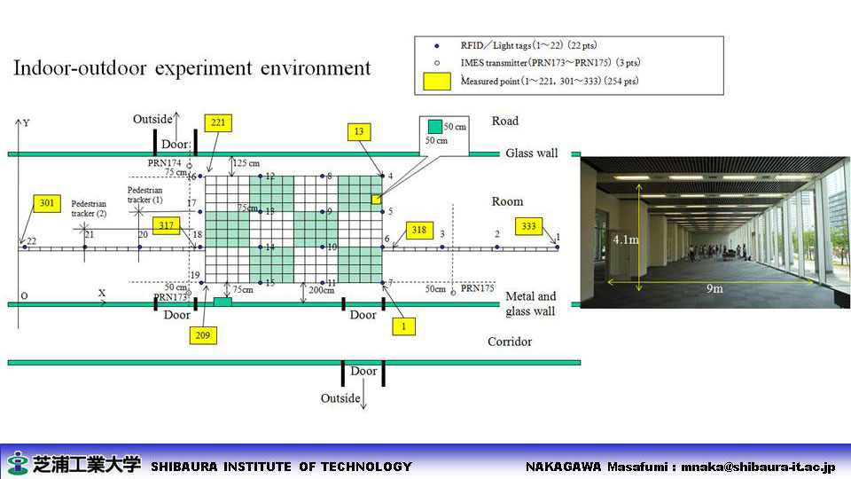
- Indoor-outdoor seamless posioning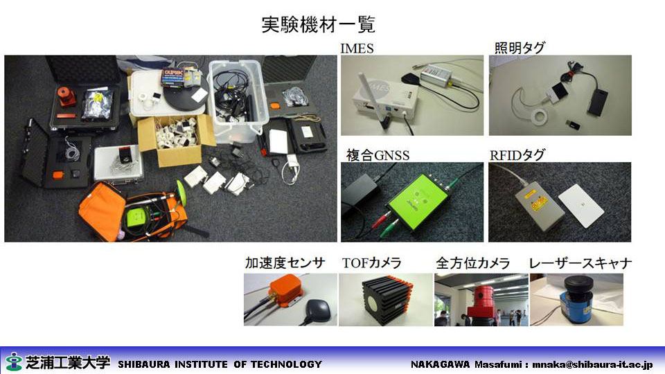
- Skymap generation from CAD data 
- Geofencing-based data distribution in LBS 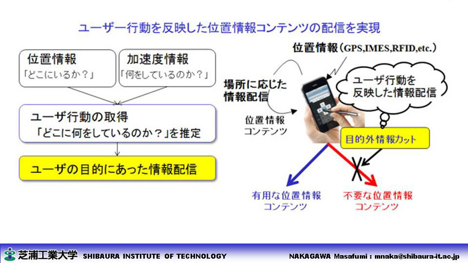
- Spatial text mining 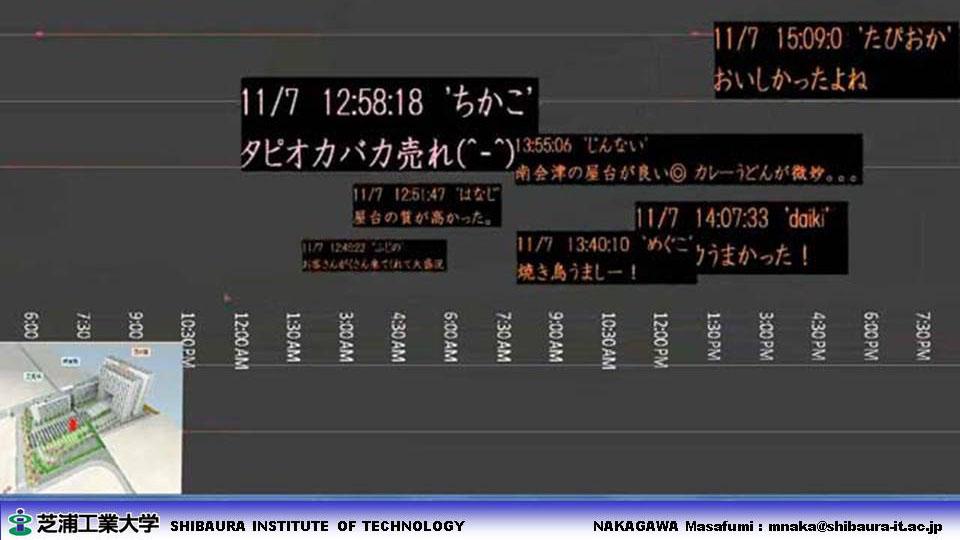
|
||
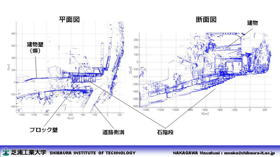
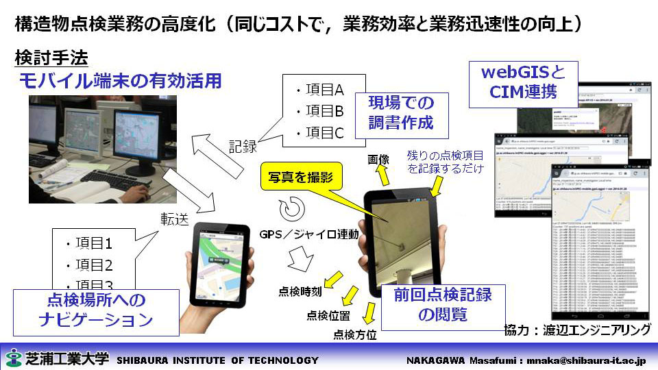
| ■ Infrastructure Monitoring |
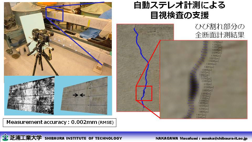
- 3D concrete crack measurement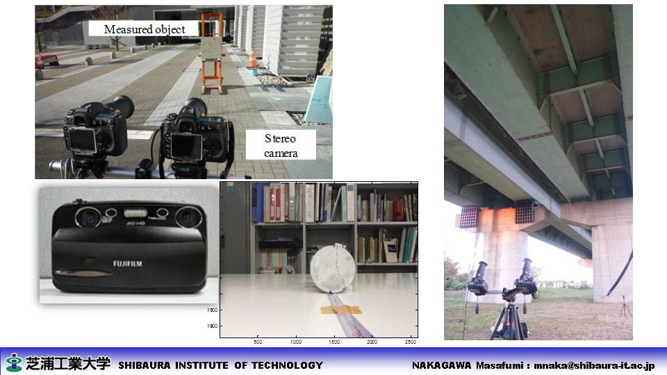
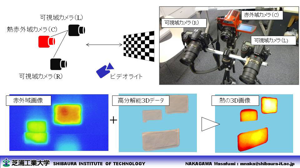
- 3D thermo measurement(IR + RGB camera calibration) 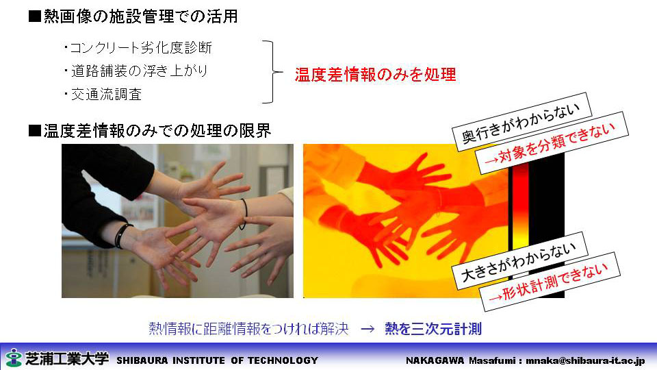
- 3D steel fatigue fracture measurement 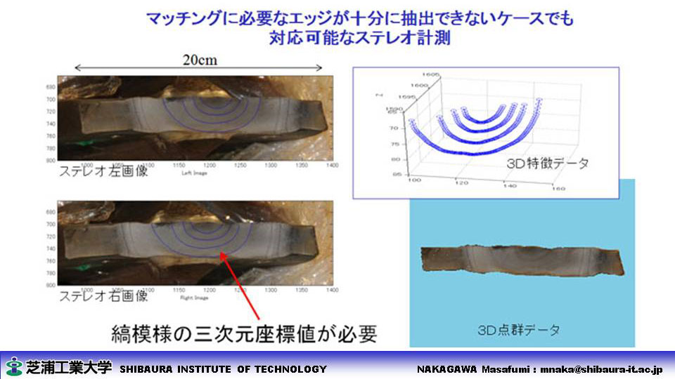
- Mobile inspection for CIM 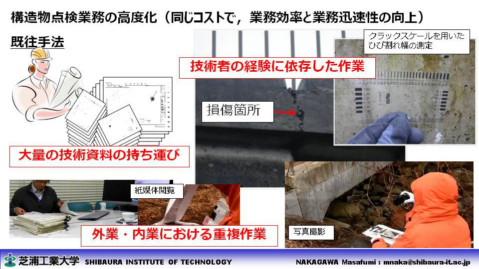
- SABO mapping using UAV 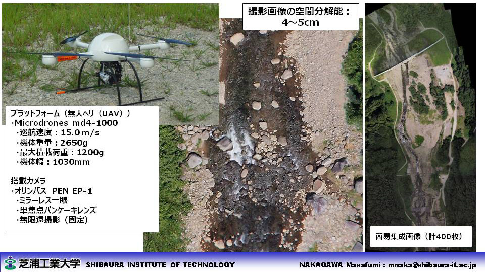
|
||
| ■ Urban Monitoring |
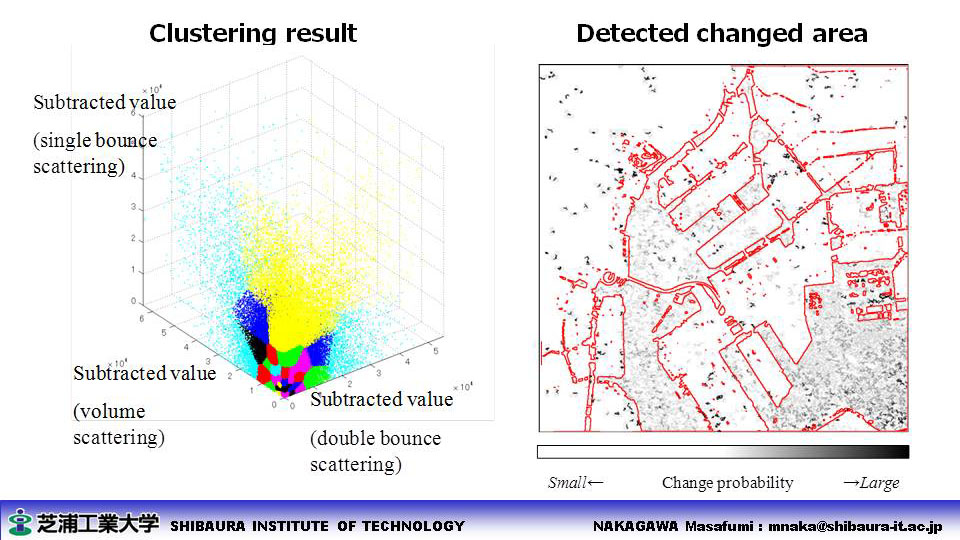
- Urban change detection using ALOS PALSAR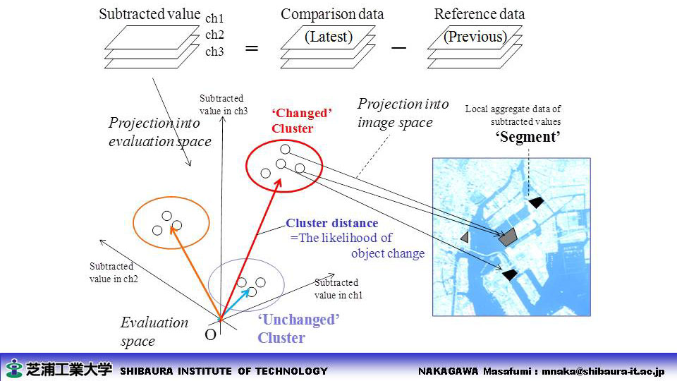
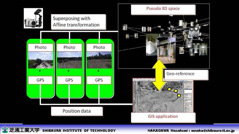
- Context-based reverse geocoding in Delft 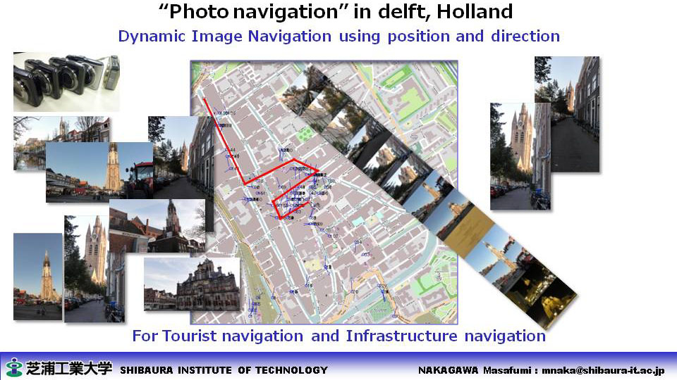
|
||
| ■ Disaster Monitoring |
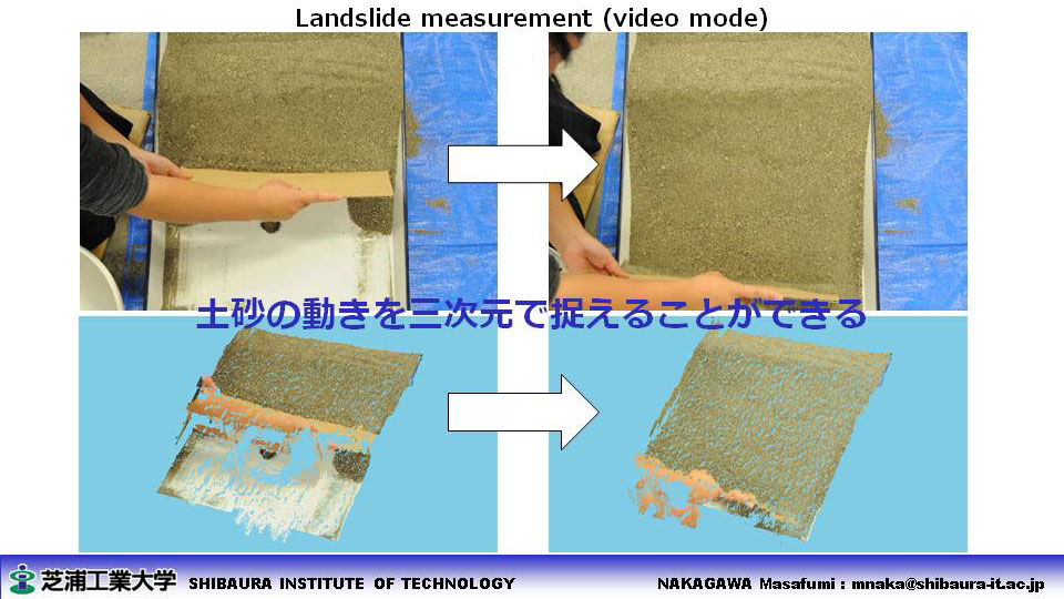
- 3D Landslide Measurement with Stereo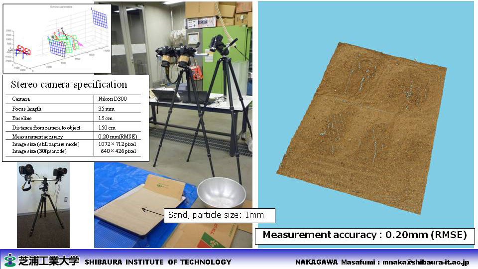
- Context-based reverse geocoding in Miyagi 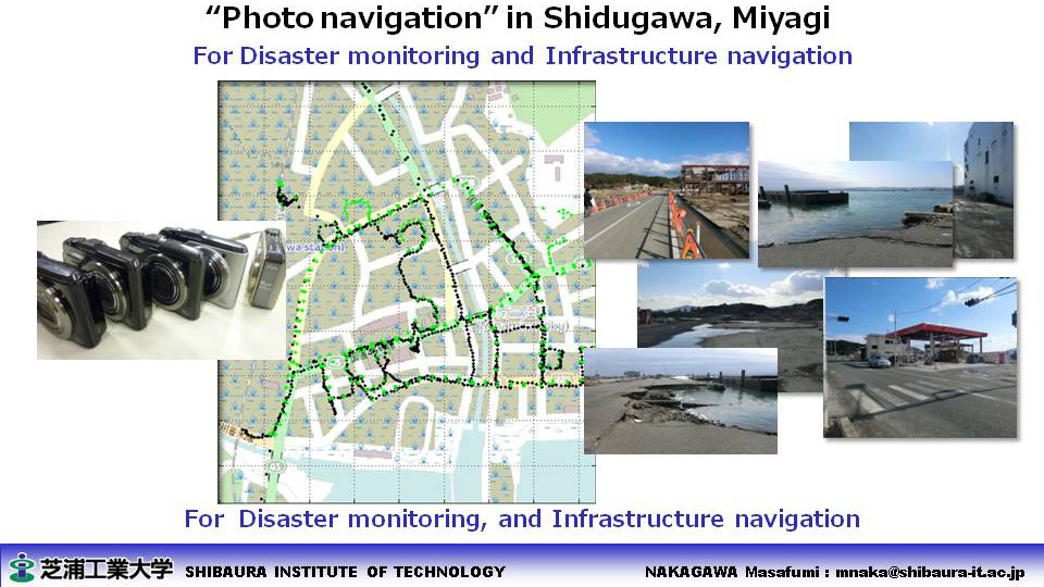
- 3D measurement with UAV (AIST) 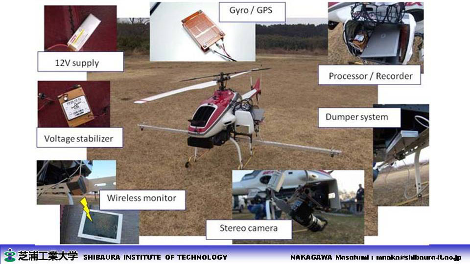
- Disaster monitoring (Satellite)  processing results
|
||
| ■ Archeology and History, World Heritage |
- Coal yard reconstruction for Kushiro museum exhibits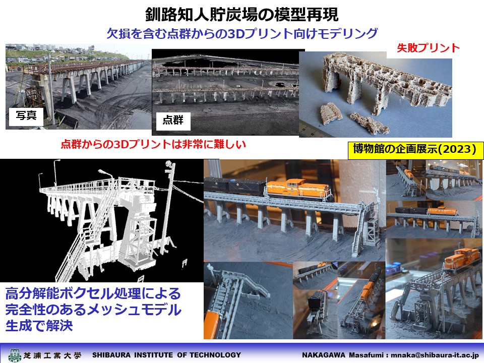
- Hiroshima Peace Memorial 3D (KRC) 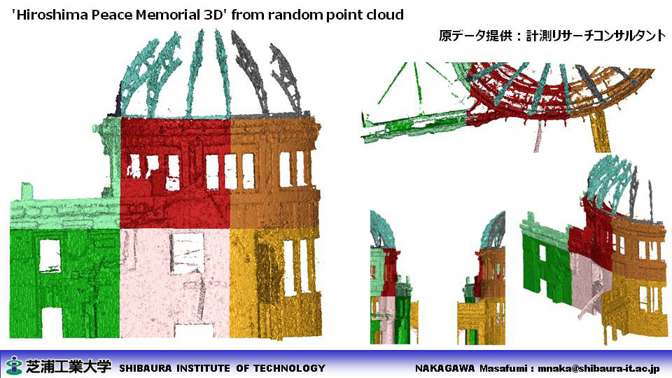
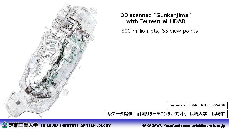
- Gunkanjima 3D (Nagasaki Univ.) 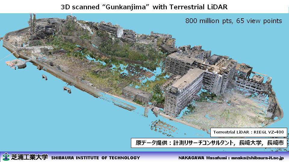
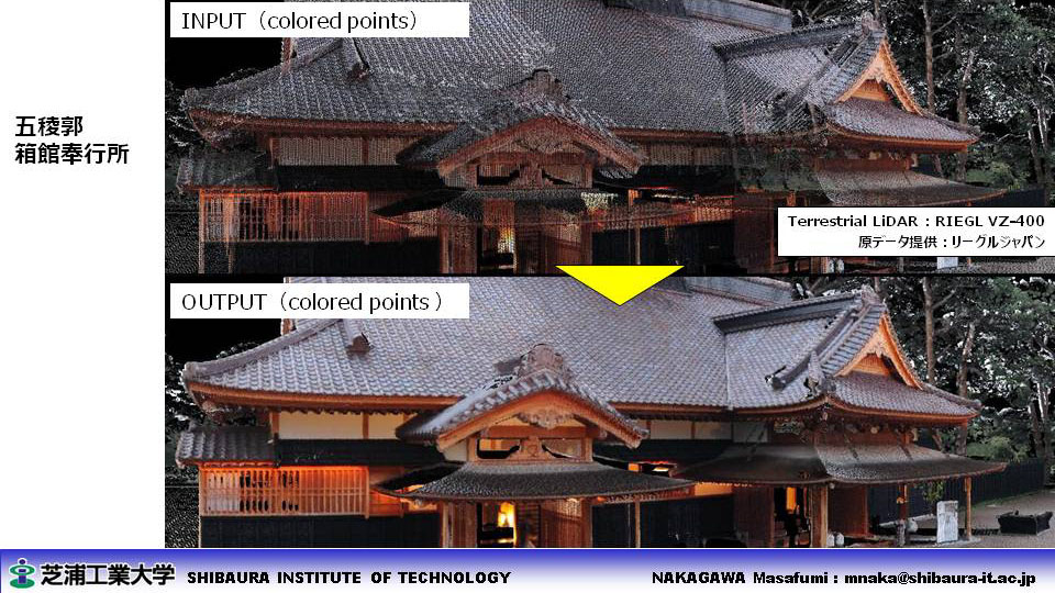
- Goryokaku 3D (RIEGL JAPAN) 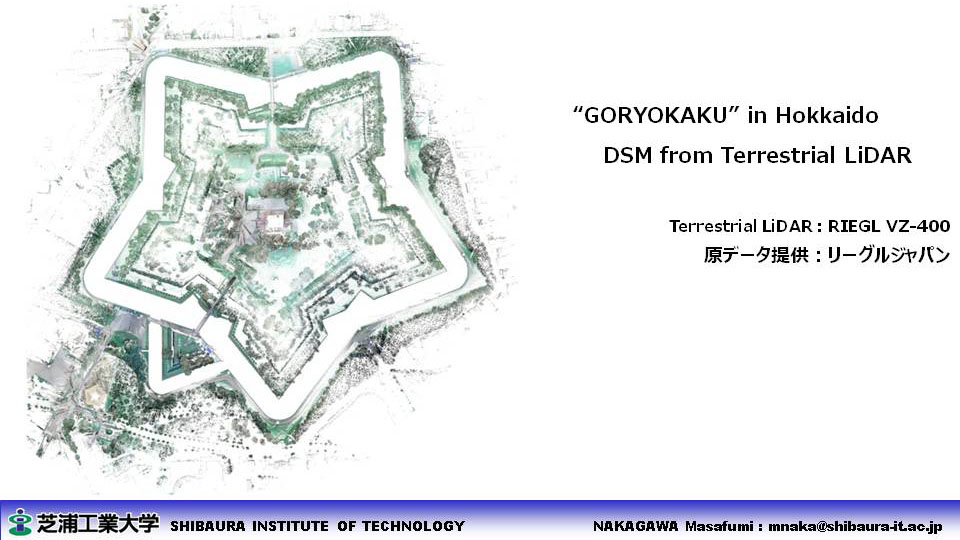
- Matsue castle 3D (KRC) 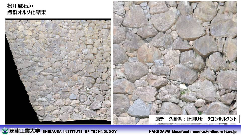
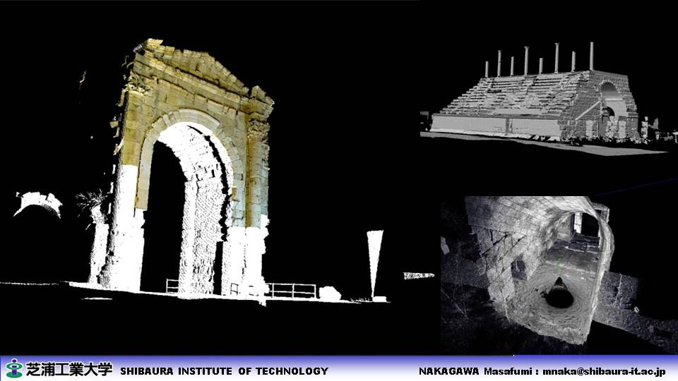
- Lebanon 3D and GIS (Tokyo Univ.) 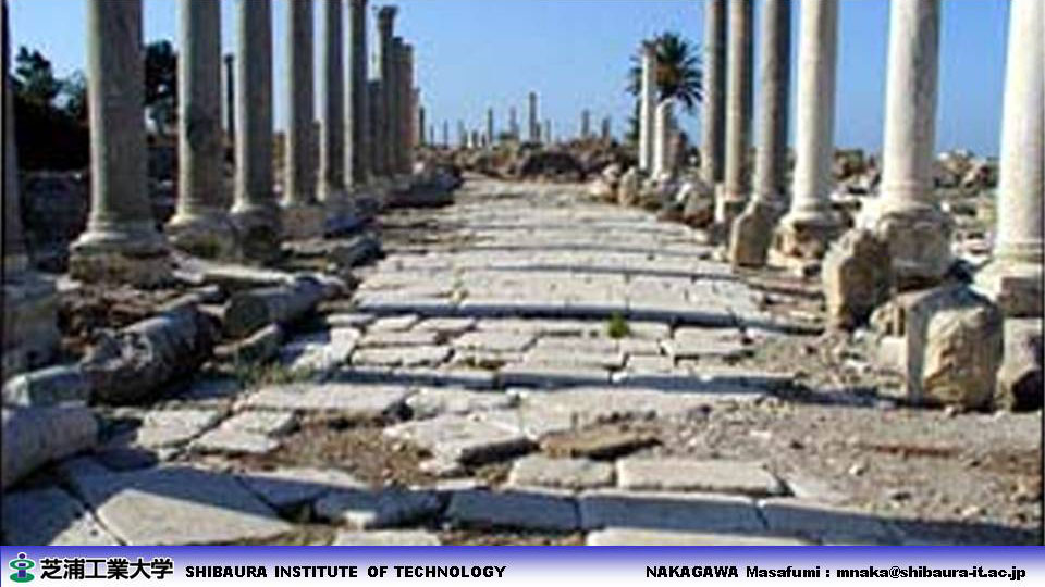
|
||
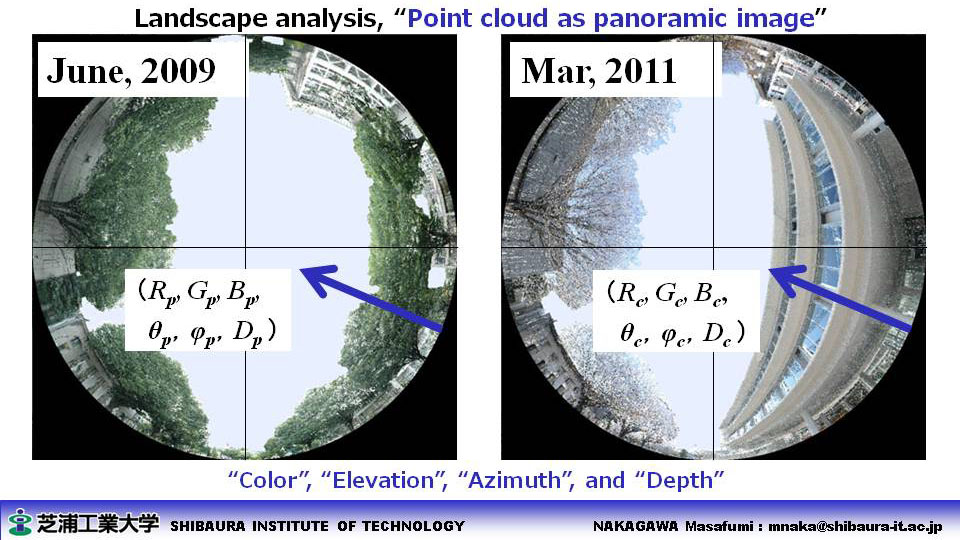
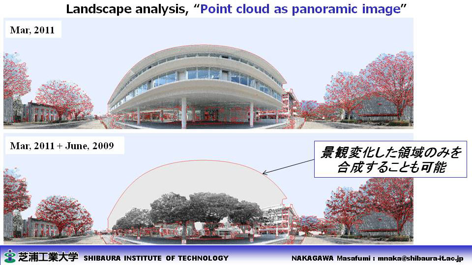
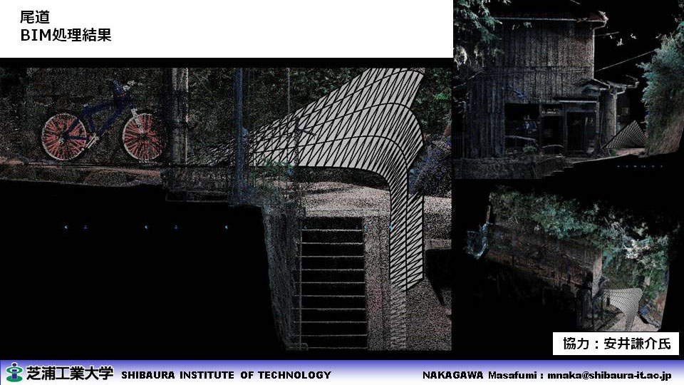
| ■ Landscape Archiving and Analysis |
- Ohmiya Campus in 2011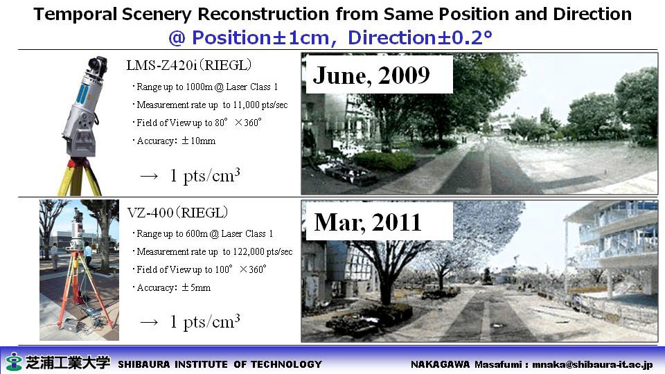
- Toyosu Campus in 2011 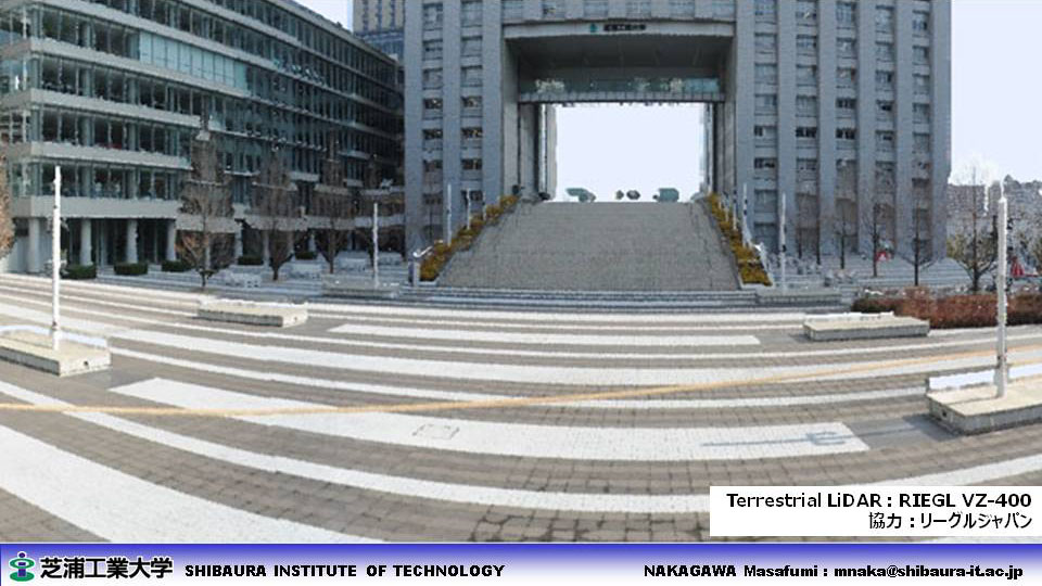
- JR Higashi-ohmiya Station in 2011 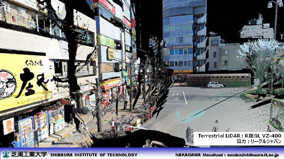
- Onomichi 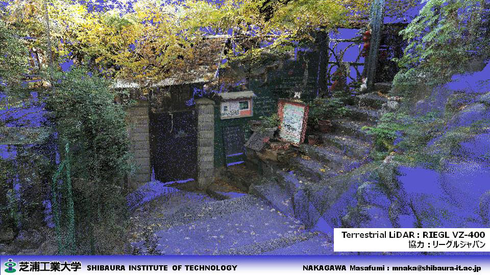
- Gundam 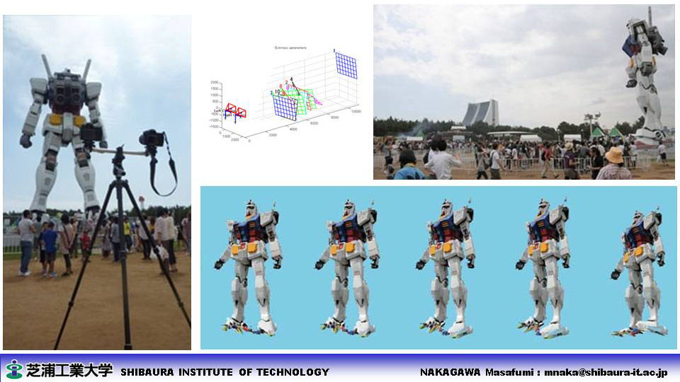
- Real World Robot Challenge  processing results
 |
||
+ Latest update: 2024/03/31